This bar contains several shortcuts to some of the most commonly used functions of the software. Same functions are also accessible from the main menu.
|
|
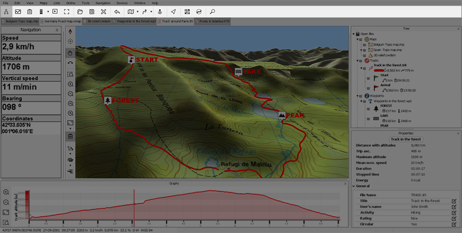
‘Data tree’: Show or hide data tree. |
|
|
‘Graph’: Show or hide view graph for routes and tracks. |
|
|
‘Properties’: Show or hide properties for maps/waypoints/routes/tracks/sets. |
|
|
‘Gradate track color’: Change the color of a track to a degradate, the color of the degradate will represent the variation of a selected data field all across the itinerary. |
|
|
‘Play a track’: Select a track and simulate its animation at real speed. |
|
‘Full screen’: Most of user interface elements will be hidden to get a wider view of the map window. | |
|
|
‘Open’: Open any element. |
|
|
‘Save all’: Save all opened elements. |
|
|
‘Close all’: Close all opened elements. |
|
|
‘Undo’: Undo the previous action. |
|
|
‘Open map’: Open any map. |
|
|
‘Open track’: Open any track. |
|
|
‘Amigos’: View the current location of your contacts on the map in real time. |
|
|
‘Activate GPS’: Connect a GPS to navigate with Land. |
|
|
‘Geocaching’: Access www.geocaching.com. |
|
|
‘Wikiloc’: Access www.wikiloc.com. |
|
|
‘Search’: Search for any location (only available for road maps). |
NOTE: You can also change the functions of this menu by opening the contextual menu on it and selecting ‘Customize’.


