
Expert operations that can be perfomed on track points:
•Delete the stopped points of a track at start/end: Track will omit the repetitive points from the beginning and the end where you stopped before and after recording the track.
|
| |
|
|
|
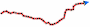
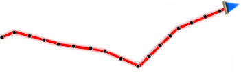
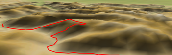
•Delete the aberrant points of a track: Points deviating excessively from the track will be considered errors, and so deleted.
|
| |
|
|
|
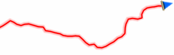
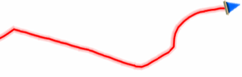
•Reduce the number of track points: Track will be drawn by keeping the shape of the original track but according to the number of points that you introduce.
|
| |
|
|
|
•Assign time/speed to the points of a track: Determine a time for departure and a constant speed so that Land will calculate the estimated time of arrival for each point in the track.
|
| |
|
09:30:15 |
50 km/h |
•Calculate land altitude for each track point: If you have a 3D relief map loaded (*.CDEM file), Land will assign to each point of the track its altitude considering the information of the loaded relief map.
|
| |
|
|
|
•Import pulse data from another file to a track: This option allows you to incorporate the pulse readings obtained by another instrument to the track.