One of Land’s most helpful capacities is the ability to create portions of any type of map (topographic, orthophotos, roads and streets...) and save them individually:
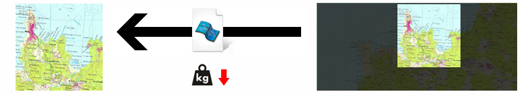
•On large maps: It is very useful to save only the geographical area of interest to you, giving you a smaller file that is much easier to transfer and process, and that is adapted your outdoor activities.
|
|
|
|
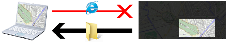
•On-line maps: Although Land offers you the ability to work with Internet maps from all around the world, sometimes you may need to access these maps when an Internet connection is not available. In these situations Land can save parts of any Internet map on your computer. This way you can have that part of the map without having to be connected to the Internet during your outdoor activity.
|
|
|
|
To create sections on maps or reliefs, follow these steps:
1. Open the map you wish to create a section of:
•Map stored on your computer
•On-line map of anywhere in the world
(Accessible from 'Data tree> On-line files')
IMPORTANT: You can only create sections of maps that are not copyright-protected.
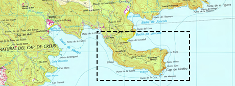
2. In the toolbar, activate the 'Selection mode' and select the portion of the map you want to generate using the original map.
|
|
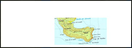
3. Once you have defined the area of the new map, click on 'Create a new map for this area ' or 'Create a new relief for this area'.
|
|
|
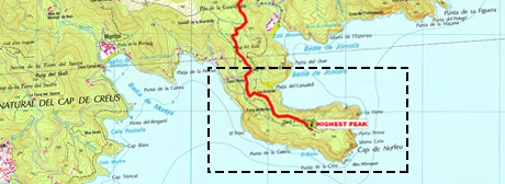
4. If the selected area contains waypoints/routes, Land will allow you to choose whether to keep these references on the map (they will be printed on the resulting map) or to just generate the map, excluding any such elements.
|
|
|
5. Assign a name and format to the newly created map, and save it.
NOTE: We recommend saving the resulting map in *.RMAP format due to its performance and compatibility with most platforms.
6. The map creation process will then start. This process can take several hours if you are dealing with large map sections.
7. Once saved you can start working with the new map without any need for an Internet connection.