Advanced operations that can be perfomed on routes:
•Edit the properties of a route:
|
|
|
|
1. Open the contextual menu of the element that you want to edit.
2. Once opened, select ‘Properties’ and modify the properties.
3. If you want to keep these modification, save the changes.
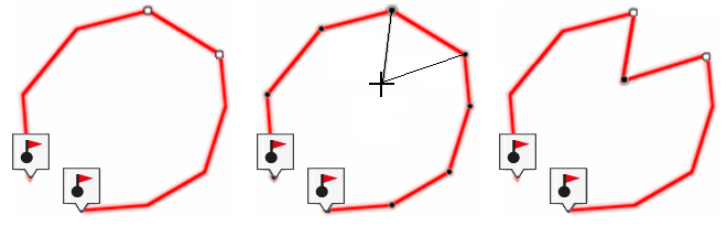
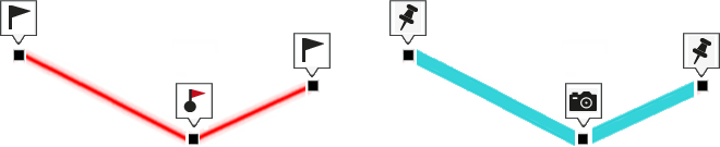
•Measure the distance between two or more points on a route:
|
| |
|
|
Distance 7.3 km |
1. At the toolbar, click 'Distance measurement'.
2. Mark the starting point on the map. If no ending point is defined, Land will measure the distance between the starting point and the current position of the mouse.
3. Then, mark the ending point on the map. If no ending point is defined, Land will measure the distance between the starting point and the current position of the mouse.
NOTE: From the vector editor you can move the created points to another location, delete them, or even create the freehand path
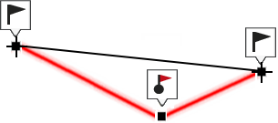
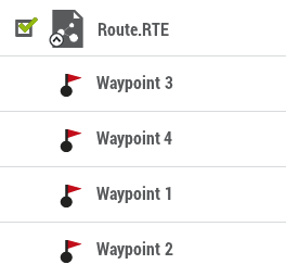
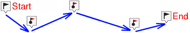
•Change the order of the waypoints in a route:
|
| |
|
|
|
1. At the data tree, open the list of waypoints for your route.
2. Drag the waypoint you want to move up or down to the position where you want to place it.
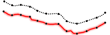
•Move the location of a track point in a route:
|
|
|
|
1. In the buttons bar, click 'Create/Edit track'.
2. Locate the track point you want to move.
3. Drag and drop the track point from its current position to the exact location on the map window where you want to place it.
4. Once finished press ‘Finish editing’.
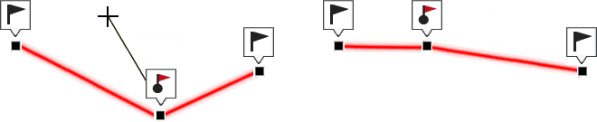
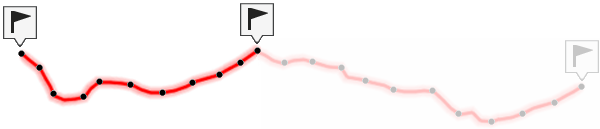
•Add track points in a route:
|
|
|
|
1. In the buttons bar, click 'Create/Edit track'.
2. At the vectorial editor, press ‘Add points’. Decide whether you want to add more points at the start or at the end of the route.
|
|
|
|
3. Once you have decided, press the exact location where you wish to create the new track point.
4. Repeat this action as many times you need.
5. Once finished press ‘Finish editing’.
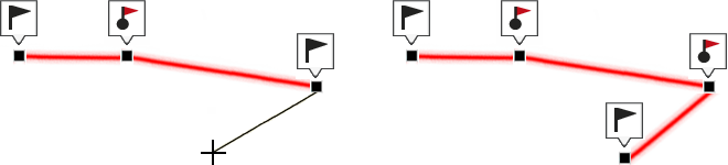
•Insert intermediate track points in a route:
|
|
1. In the buttons bar, click 'Create/Edit track'.
2. At the vectorial editor, press ‘Insert intermediate points’. Select the track point after which you want to add a new point.
|
|
|
|
3. Press the exact location where you wish to create the new track point.
4. Once finished press ‘Finish editing’.
•Move the location of a route:
|
| |
|
|
|
|
|
|
|
X: 0 m Y: 0 m |
X: 0 m Y: -500 m |
1. At map window, open the contextual menu at the track you want to move.
2. Select ‘Tools > Move track’ and write the variation of X (abscissas) and Y (ordinates) to adjust the new location of the route.
•Delete a track point in a route:
|
|
|
|
1. In the buttons bar, click 'Create/Edit track'.
2. At the vectorial editor, press 'Delete points'. Select the track point you want to delete.
3. The two adjacent track points will be joined in a straight line (this straight line will not contain any points).
4. Once finished press ‘Finish editing’.
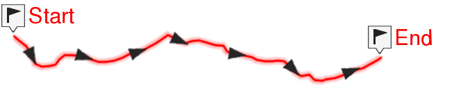
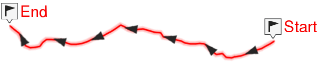
•Invert a route: In order to display a route in the opposite sense to the default one (the begining at the end and vicecersa).
|
|
|
|
|
|
|
|
1. Open the contextual menu on the route.
2. Press 'Tools > Invert track'.
|
|
|
|
|
|
|
|
1. Open the contextual menu on the route.
2. Press 'Tools > Convert TRK to RTE’.
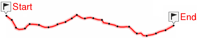
•Convert a RTE into a TRK
|
|
|
|
|
|
1. Open the contextual menu on the route.
2. Press 'Tools > Convert RTE to TRK'.