Functions accessible from: 'Main menu > File > Preferences > View > Graphs'
Land features a graph representation system that may be useful for to analyse and appreciate the variations of routes while working with maps:
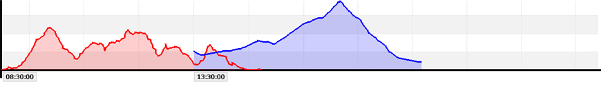
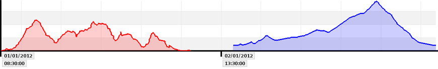
•To take account the day: If several tracks are displayed at the same graph, they can be represented differently:
•No ignore day: Chronologically taking into account the day in which they were recorded.
|
|
•Ignore day: Chronologically taking into account the hour in which they were recorded.
|
|
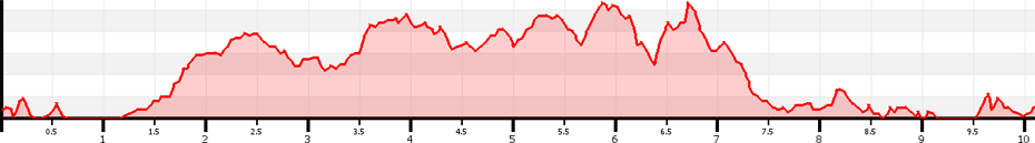
•X axis: Set the field that will be displayed at X axis.
|
|
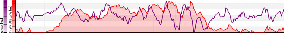
•Configure Y axis fields: Set the fields that will be displayed at Y axis (you can choose more than one field).
|
|