Functions accessible from: 'Main menu > File > Preferences > View > Data tree'
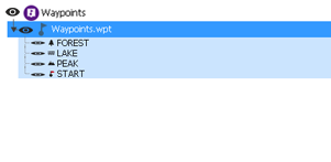
From the data tree you can manage your maps/waypoints/routes/sets by accessing the different sections. Press on data tree elements in order to activate them or access their sub-menus:
•Animated data tree: When managing elements of any list, Land displays an animation effect to easily see in which elements are you working on.
|
|
|
|
•'My Activities' and 'Routes' view: Land classifies the routes into two types according to the use that is going to be given to them:
•My Activities / Routes (default view)
§ My activities: Tracks recorded directly with your GPS. Displayed with an activity is the icon for the sport you had set on the device during the outing (hiking, mountain bike, road bike, trail running...). Check the list of activities available from ‘Data tree > My activities’.
§ Routes: Tracks obtained from other sources (recommended by a friend or downloaded from the internet). Check the list of routes available from ‘Data tree > Routes’.
•Routes / Tracks
§ Routes: Tracks from any source recorded in *.RTE format. Check the list of tracks available from ‘Data tree > Tracks’.
§ Tracks: Tracks from any source recorded in formats other than *.RTE. Check the list of routes available from ‘Data tree > Routes’.
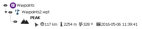
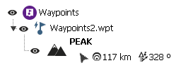
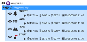
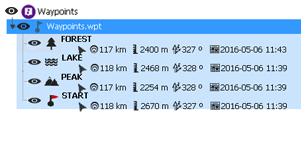
•Information in lists: Display more information for listed elements. Extra information will be presented in a 2nd line right after the name of the item. Select the data fields that you want to display.
|
|
|