Land is the perfect software to prepare and analyse all your outdoor activities (Windows/Mac platforms). With Land you will be able to analyse your trips and manage all data recorded by TwoNav comfortably from home. You can get the latest version of Land from http://www.TwoNav.com (learn more about Land by downloading the full manual).
Connection TwoNav-Computer
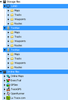
After installing it, all you have to do is connect your TwoNav device to the computer (Windows/Mac). Then Land software will automatically detect the device and display it at ‘Storage files' branch in the data tree.
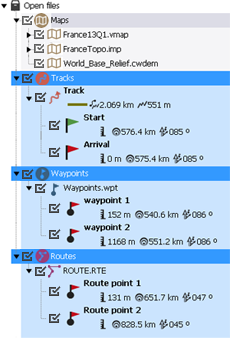
Under the name of the device you can view its content classified by type of item (maps/waypoints/routes/tracks).
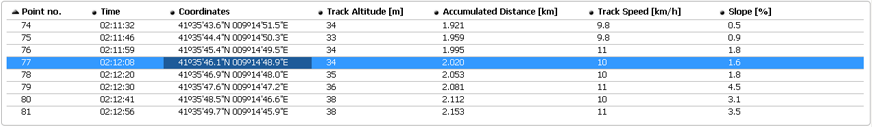
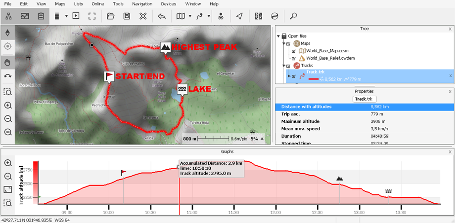
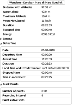
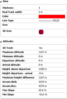
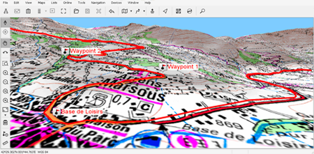
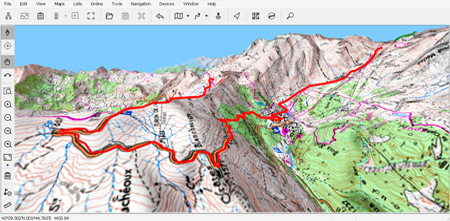
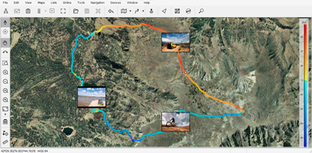
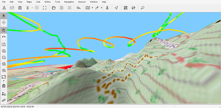
Analyse data
|
|
|
|
|
Land is based on a user-friendly interface, specially desgined to manage the application easily: open a file from a TwoNav device is as easy as do a double click on its name at the tree data.
NOTE: Remember that opened file are still stored in the memory of the device. If you want to save them on your computer, select ‘Save'.
|
|
|
|
|
|
|
|
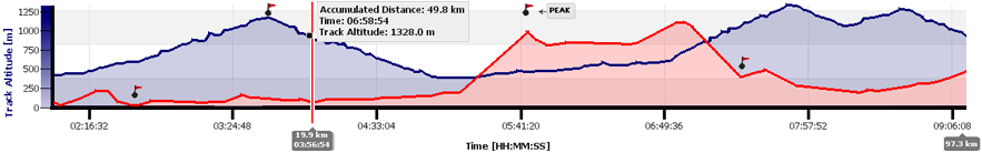
Once opened, the file will appear in the branch 'Open files' at the data tree. Then, you will be able to start working with it: place it on the map page, analyse its properties, compare its data using graph representations…