
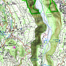
2D FLAT
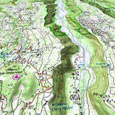
3D FLAT
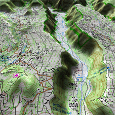
3D+ RELIEF
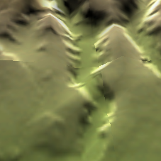
RELIEF MAP
|
| |||
|
|
|
|
|
|
|
|
|
|
|
2D FLAT |
3D FLAT |
3D+ RELIEF |
RELIEF MAP |
The device offers several visualizing modes so you have the most adequate perspective in each moment.
•‘2D flat’ mode: Zenith plan.
•‘3D flat’ mode: Trimensional flat image with a perspective.
•‘3D+ relief’ mode: Orography of the terrain in real 3D (vectorial maps will not be displayed in 3D+). This mode can only be displayed if you load:
•3D relief map (*.CDEM)
•Raster map (normally *.RMAP or *.RTMAP)
IMPORTANT: Press ‘2D > 3D > 3D+’ button at the tool bar to switch between viewing modes.
•‘3D’ mode: Choose the sequence for ‘2D > 3D > 3D+’ button:
•‘2D flat > 3D flat’: 2 positions ‘2D > 3D’
•‘2D flat > 3D flat > 3D+ relief’: 3 positions ‘2D > 3D > 3D+’
•‘2D flat > 3D+ relief’: 2 positions ‘2D > 3D+’ (your device will try to show 3D+. If not possible, 3D flat will be shown)